
No higher resolution available.
Frost_Line_Map.jpg (739 × 488 pixels, file size: 105 KB, MIME type: image/jpeg)
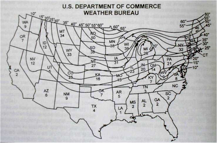
Frost Line Map from National Weather Service
File history
Click on a date/time to view the file as it appeared at that time.
| Date/Time | Thumbnail | Dimensions | User | Comment | |
|---|---|---|---|---|---|
| current | 22:44, 21 October 2019 | | 739 × 488 (105 KB) | ajw22 (talk | contribs) |
You cannot overwrite this file.
File usage
The following page uses this file: